Tel Dan Nature reserve hosts the largest, most vigorous tributary of the Jordan River. Lush vegetation year-round, ancient grand trees, historical sites go back to Canaanite period. AND: fantastic fish restaurant/farm nearby.
Lost City by the Lebanese Border
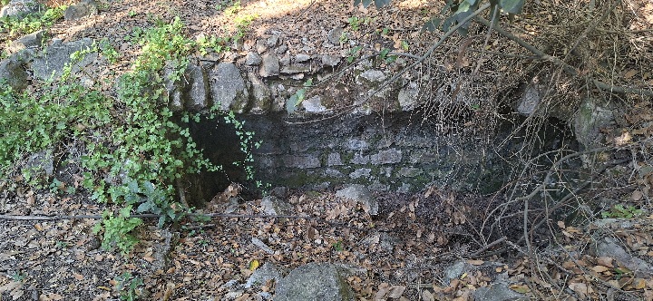
We set on our way, ready to encounter a “lost City”; no further details were given.
The drive into the Upper Galilee was beautiful, as always, green and lush.
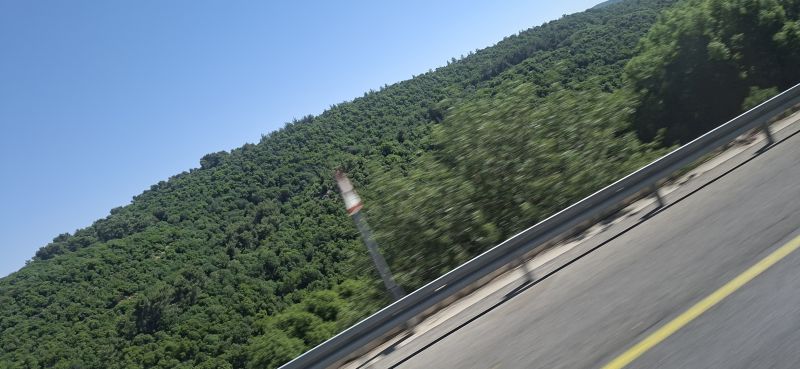 Lush and green native forest en route toe the Lost City
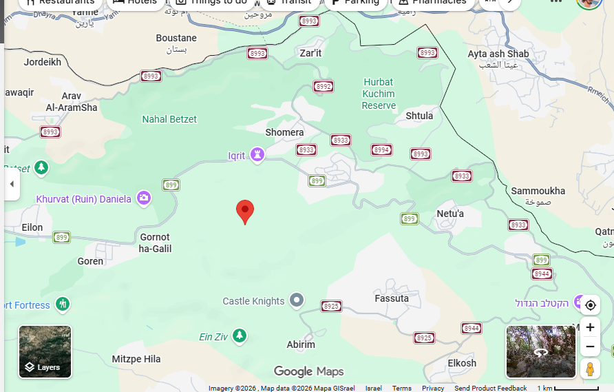 Map shows location of Hirbet Tsunam ( The “Lost city”). Grayish uneven zigzagging line on north is the Lebanese border.

Thanks given to the Forest Peony
Once we passed the Druse village of Hurfeish, the road leading west got rugged and uneven, then ended abruptly when we reached the peony greenhouse, owned by one of the Jewish villages in the area, Shomera or Even Menahem (see map). If it wasn’t for the greenhouse, there would have been no road at all, and the lost city would be even more lost.
Left: Forest peony grown in greenhouse.
Sun, rocks and prickles – the route to the lost city
We set off by foot through the brambles, plentiful at this season in Israel. I came with shorts and sandals, not a great choice.
The terrain was a bit rough for us, group of elderlies, a walk that would have been nothing for me even ten years ago. At any rate, it meant the pace was slow, and people helped each other without condescending.
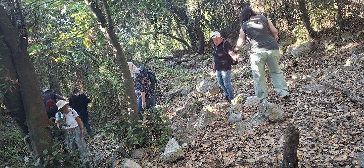 A little bit rough for the elderly. We all help each other.
As we walked through the forest, our guide would bring to our attention the vegetation and the fauna. The forest is mostly composed of sturdy, well-established laurel bay trees and the relatively rare Aleppo oaks. The laurel leaves have multiple medicinal, culinary and traditional uses. The tree, which requires humidity, is native to the Mediterranean, and used to cover vast areas. Now it is fairly rare. At one point the guide made us stop to watch a stick insect slowly vibrating on her hand.
Mole rats, common to the region, are known to dig out the plentiful pot shards in the lost city area. During our walk, we found mostly yellow shreds ascribed to the Muslim period laying on the ground.
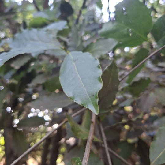
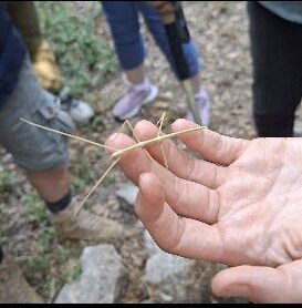
Pictures Laurel bay leaves; stick insect
24 “lost cities” and counting
 Map shows the lost cities around the Galilee (https://www.omri-travel.co.il/)
Our tour guide told us that during Byzantine times there were at least 24 settlements, both Jewish and Christian, in this area, and both churches and synagogues were discovered.
Christians settled the Galilee since the fourth century when Constantine accepted the religion and declared it the official religion of the Roman empire, to then be called Byzantium. Islam wasn’t invented yet. Jews and early Christians lived side by side on the Land. I would love to know more about the relationships between the two religious groups at the time.
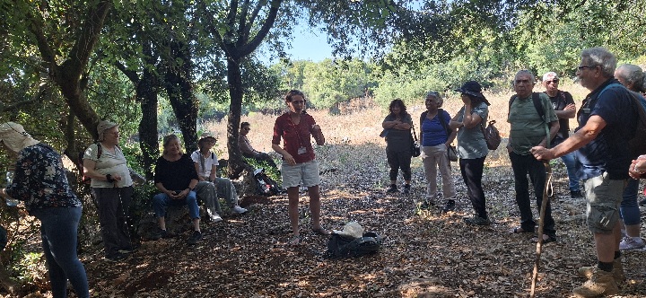 The group getting an intro to the hike from Karmit Arbel
In the above picture you can see our wonderful tour guide, Karmit Arbel, getting us ready us for the walk into the actual lost city area, also known as Hirbet Tsunam.
So why are the cities “lost”?
Roman-Byzantian paradise
At the beginning of the 20th century, when Jews started returning to the Land, the total population in the country was about half a million. In contrast, during Byzantine times, which were a direct continuation of the Roman period, the population reached close to 3 million. Roman roads, construction techniques and sophisticated engineering developed the land and created affluence. Pilgrims came from Christian Europe. Olives and vines were grown for export and sold as “Made in the Holy Land”. A main artery connected Antioch in Asia Minor to Acre, where a busy port connected Israel to Europe. Both empires, the Roman and the Byzantine, provided stability and affluence.
The Galilee, in particular, was booming with towns, villages and farms. Large olive presses produced oil for export. The area was highly populated and thriving during the Byzantine period, between the 4th and the7th centuries.
Islamic decline
However, in 638 AD paradise was over when Omar ben al Khatib conquered the land of Israel for Islam. Since the Arabs did not have a navy, they destroyed all the coastal port cities and built castles in their stead to prevent European attacks from the sea. This way they ended commerce and upended the economic basis of most of the settlements in the country at the time. Many of the villages in the Galilee were abandoned. Overtime, native shrubbery and forest took over.
Only several villages, like Fasuta and Mi’ilia, survived the onslaught. (Read my post winter holidays in the Upper Galilee) about these Christian villages today.
Furthermore, this destruction of the coastal towns and of the Roman water conduits ended with the area deteriorating ecologically and turning into swamps, which covered wide areas until the renewed Jewish settlement in the 20th century, where now the majority of the Jewish population lives.
Why is there no road to the lost cities?
There might be several reasons why a proper road does not reach the “lost” cities :
1. Our guide upheld the notion that the current government is less interested in spending money on digging obscure Christian villages, even large and important ones. They do not add to our narrative and might not serve as tourist attractions. The above-mentioned Wikipedia post about Hirbet Tsunam (in Hebrew) states that “the site is expected to stay “humble and intimate“.
2. According to the guide, the Christians themselves are more interested in sites where Jesus held sermons, performed miracles or walked on waters. These villages have none of these bonuses.
3. Additionally: the archaeologists do not want the sites vandalized. Ms. Arbel told us that in Hirbet Dor, a bit to the north, precious couple sarcophagi that were dug out were found broken, obviously vandalized. Perhaps until permits are given to dig the ruins further, the way to go is therefore to minimize human access.
4. In my humble opinion, another possible reason could be the proximity to the border, where Hezbollah operatives might be active, or fly missiles or drones over the diggers and visitors. Indeed, even during our short visit, we heard very loud explosions (caused by the IDF actually) from the other side.
Which direction do you pray?
Jews pray to Jerusalem, whether they are east, west, north or south of it.
Muslims pray to Mecca. A Mihrab is a niche in the mosque wall, pointing to the Kibla, the direction of the Kaaba in Mecca. Some Mihrabs were found on these sites,
Christians on the other hand, pray due east.
Orientation is for orient
Our guide explained that Jesus is considered the new light onto the Earth, hence the Eastern direction. The Bizantine churches were built with altar and sanctuary facing east.
More explanations:
- Christs’ return. Jesus said, “For just as the lightning comes from the east and flashes even to the west, so will the coming of the Son of Man be”. Facing east symbolizes expectant waiting for His return.
- Christ as the Sun: In scripture, Christ is called the “Sun of Righteousness”
- The Garden of Eden: The Book of Genesis states that the Garden of Eden was planted in the east.
From my own meager knowledge of Christianity, I will add that the famous star announcing Jesus’s birth rose in the East, and the magi followed it from their abode way in the East to the famous stable in Beth Lehem.
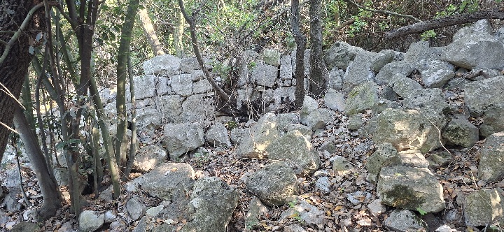
As much as a lost city was expected, we gasped at the first sighting of the ruins amidst the jungle-like vegetation.
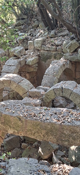
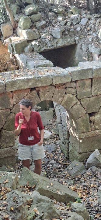
You can easily see the amazing constructive skills these ancient Christians employed in their buildings – the precise cutting of the large stones, the sturdiness of the structures, and especially – the arches techniques continued from the Roman period. The Romans developed the engineering marvel of a headstone and wedge stones, creating the exact sideways and downwards pressures to keep the arch standing solidly without mortar. And, lo and behold, they stand steadfast for thousands of years!!!
Fantastic Byzantine arches still standing. Right: our guide against the background of Lost City construction marvels
Two or three words on our tour guide
Karmit Arbel is an amazing, energetic, lovely and lively woman, with tons of knowledge she just loved to impart to us. Exuberant and vivacious, curious and multi disciplinarian, she fits so well with the Indiana Jones surroundings.
Living in Matat, a high north community, she had to be evacuated from her home and community, following the October 7th disaster, like all the other residents. Though they returned eventually, life went through a major obstructive trauma. Many households economies were ruined as well, especially in the tourist industry, a mainstay of the northern Israeli economy. Since Covid, and especially in the wake of all the wars, tourism in the country generally had dwindled to a trickle, and in the Galilee in particular. Even the devout Christian pilgrims stay home nowadays. Tour guides like Karmit have to make do with groups of elderly Israelis like us to make their living…
The Indiana Jones look, Lost City, Hirbet Tsunam
Nothing and nobody in the Middle East can survive without a reliable supply of water. God punishes His people repeatedly by holding up the water from the skies.
The eternal questions – a well or a cistern?
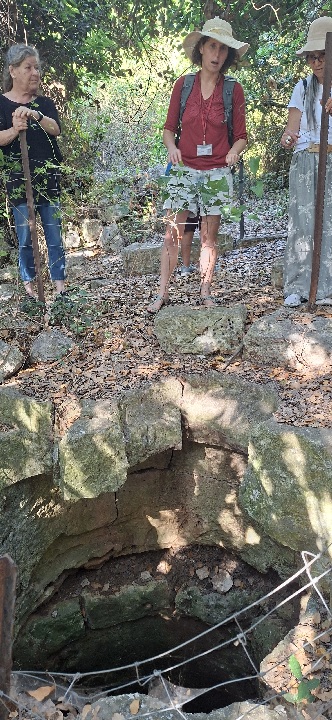
The two basic ancient ways of getting water anywhere are the well and the cistern. When Karmit asked us if this was a well or a cistern, I knew the answer instinctively, but could not explain why. A well just has another look. Karmit explained it was the mortar on the walls, protecting the water from seeping sideways and getting lost, and the terrain around, adjusted to cahnneling the water.
A well is a hole you dig to reach ground water and hoist it upwards. A cistern collects rain water, ideally from as wide as possible basin and with pipes or canals leading to it.
Even with plenty running water in an area, a cistern was used to keep water cool and clean. The ring around the cistern provides extra protection.
The ancient cistern still keeps its function. A stone we dropped in hit water some 5-10 meters below.
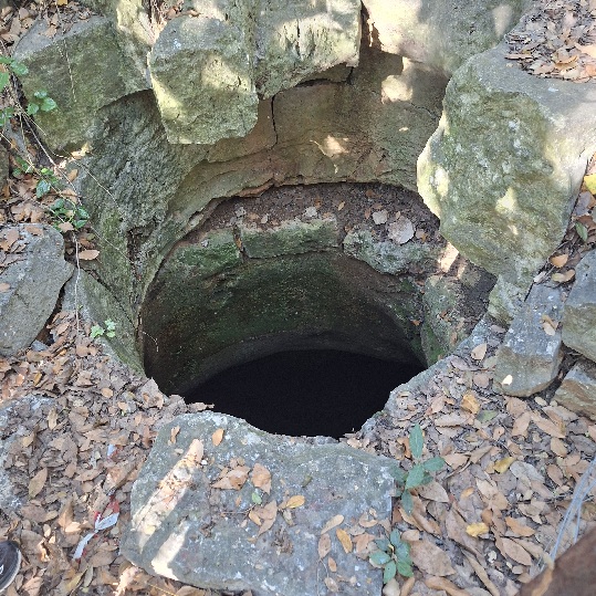 Lost City cistern with stone ring for cleanliness. The ancient cistern still keeps collecting water.
My water is holier
Both Christians and Jews held water reservoirs underneath their churches and synagogues, respectively, and offered it for free to the believers. The goal was to attract people to the facility and the faith. In those days water was the main treasure people sought.
Here is a reference to an article about Jewish cisterns in the town of Beit Shearim, used both for consumption and for purifying, religious bathing.
As to churches, AI summarizes: “Churches in the Galilee often feature ancient, subterranean water cisterns and mikvehs (ritual baths). Because the region relied on harvested rainwater for survival, ancient cisterns were built beneath homes and community centers. When these structures were later replaced by Byzantine, Crusader, or modern churches, the original cisterns were often preserved in their crypts. “
Left: The cistern
Extracting olive oil – the ancient Galilean tradition
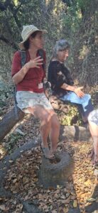 In these two pictures you can see a “memel”, the stone used to crush the olives in the press. The memel, the upper stone, was usually turned by the force of animals, to crush olives sitting in the “sea” (yam), the bottom stone. The oil would flow into a basin below.
In a series of posts about olives and olive presses in the Galilee, I wrote that scientists found out this area to be the first in the world to domesticate the olive.
The most ancient presses were found near the Kinneret (Sea of Galilee).
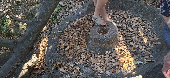 Karmit standing over the memel (crushing stone) used to extract olive oil. Lost City, Galilee.
A viewpoint on the way back to the bus allowed us to glimpse the village of Ikrit (see the map above). This is an open wound in Israeli history – two Christian villages, Ikrit and Bir’am, whose residents were expelled by the IDF during the 48 war, were promised by Ben Gurion a return to their homes in two weeks. However, the promise has never materialized. Instead, the villages were destroyed several years later, leaving only the cemeteries and churches intact..
Our tour guide told us a bit about the villages. Today Ikrit people live in 14 different villages in the country, and the people of Bir’am are mostly in the nearby village of Gish, and some in Lebanon. They succeeded through a claim to the High Court to earn their right of return, but it did not happen. At the time, PM Rabin talked about compensation and construction, but then he was murdered, and the government had changed as we all know.
The churches are maintained year-round and visited mostly on holidays and other occasions. Karmit said they organize yearly summer camps for the kids and youth in the church to keep it active.
 Ikrit church with Christmas tree. https://www.nytimes.com/2022/12/24/world/middleeast/christmas-tree-iqrit-palestinian-christians.html
The Ikrit and Bir’am people distinguish themselves from the Nakba narrative. They say theirs is a different story and want remediation. Youth from Bir’am established a premilitary preparatory, they draft to the army and want to be called Armaics, not Arabs. Some of them, according to the guide, became very right-wing, but others are still frustrated with their particular history.
Recently, Hezbollah shot a missile right over the church as it housed a military unit.
On the way home we stopped at a very special site just outside the Druse village of Hurfeish.
In memory of the sons
Hurfeish is a Druse town, or large village if you will, defined as a regional council, with more than 6000 residents, and expanding. The Druse serve in the Israeli army and are very proud of it. Their participation in the IDF is beyond reproach. Nowadays, they serve in every unit, fulfil the hardest tasks and pay with the lives of their sons.
I wrote plenty about the Druse, our silent allies, as I called them, based on previous visits to their villages. You can look up my writings on their secretive religion, the grave Syrian situation, their cemeteries, women’s position and more.
As mentioned there, due to their belief in reincarnation, they do not have regular cemeteries, except for the military fallen, to give them the honor, as do the Jews. They also initiated a project, “The Path of the Sons“, as their special way to commemorate them. This park in Hurfeish is yet another such project.
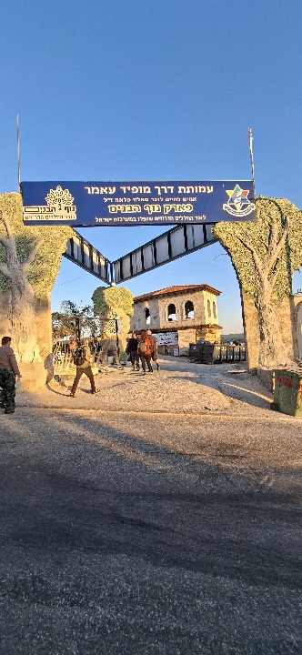
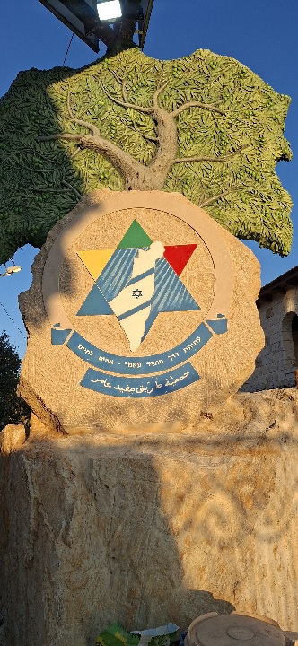 Entrance to Park Habanim, Hurfeish, Upper Galilee
The Nof Habanim park (The Sons’ View Park) is placed in a beautiful viewpoint over the green forest, and provides a great vista of the western Galilee all the way to Haifa. There are walking paths, tables for picnics and sitting corners.
We arrived at sunset. Religiously-scarved women were seated at tables in the back; colorful lights were marking the main path; the atmosphere was subdued and joyful simultaneously.
After a while a Druse man came up, talked to us about the Druse participation in the wars and handed us a booklet about the park project and the related NGO. Some of us were also handed a massive book about the special Druse unit that used to exist in the past. Now, as I mentioned above, they serve in all IDF units and in high commanding posts as well.
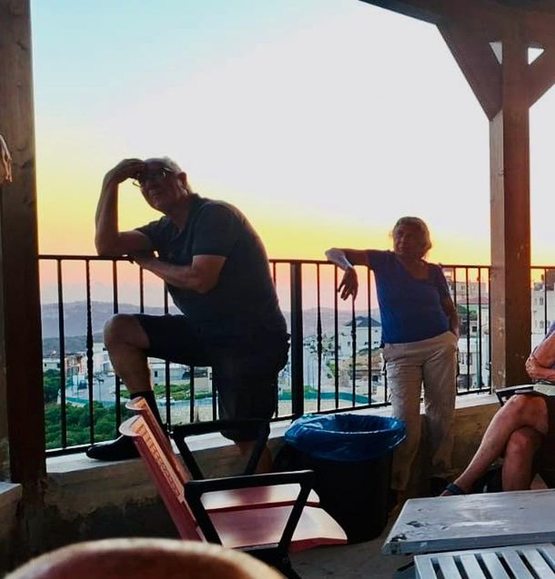
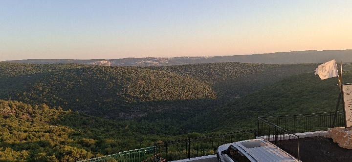 The magnificent view over the Western Galilee, Park Habanim, Hurfeish. Top photo courtesy Shmuel Sela, Kibbutz Parod.
Something to eat?
We scrambled through Hurfeish’s main street in vain. The town is fairly large, bigger than expected and sprawling, but everything was either closed, or it would take too long to prepare the famous cherished Sambuseks. After some deliberation we headed back to the bus, meaning we will have to return another time for sure….
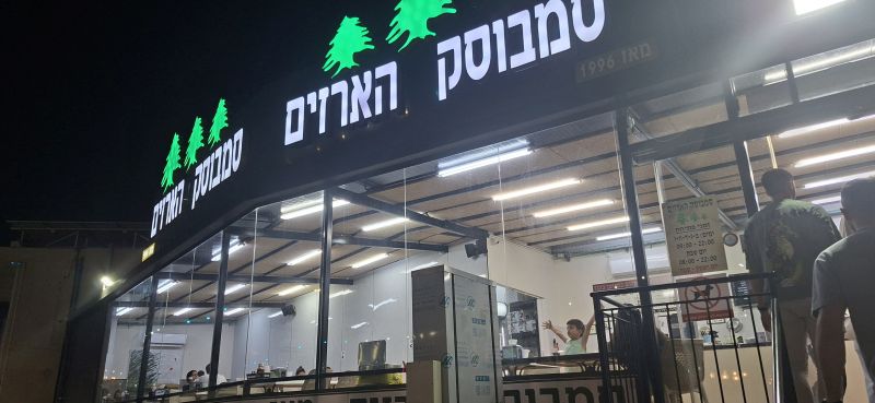
A photo of Sambusek Ha’arazim, a famous eatery in Hurfeish, where we could have eaten but didn’t… Alas…

Related Posts


Comments (0)